
Video & aerial
Horizontal for the property website. Vertical for the phone, with you on camera if you want it. Aerials cover what a camera on the ground cannot reach — acreage, shoreline, and where the lot actually ends.
Every shoot already comes with photo reels in the marketing kit, free. What is on this page is filmed: real video of the property, and the vertical reel puts you in front of it.
Recent video
- 2015 N Shore Dr, Clear Lake
- 2101 North Shore Dr, Clear Lake, IA
- 1811 N Shore Dr, Clear Lake


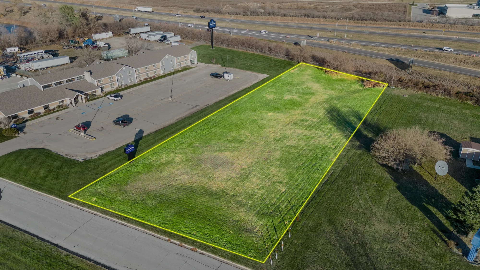
Lot lines drawn on the photograph
A parcel is hard to read from the air, so we draw the boundary straight onto the aerial. Most useful on acreage, corner lots, and anywhere the lot runs further back than it looks.
- Included in Home Sweet Home and Land & Air
- Add Property Outline to any other package
- Drone photography can be booked on its own